Bob Terrell State Wildlife Area

Bob Terrell State Wildlife Area

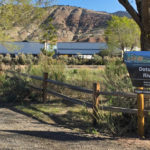
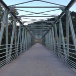
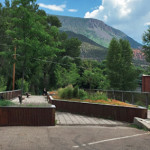
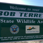
Connects: Carbondale (6,180 ft), Roaring Fork River, Highway 82, Highway 133 (West Elk Loop Scenic Byway), Red Hill, Veterans Memorial Bridge Carbondale, CO – Wildlife Area The Bob Terrell State Wildlife Area, formerly the Koziel Boat Launch and commonly referred

Posted in Boat Launch, Carbondale, Carbondale Parks, Dog Friendly, Parks, Recreation Area, Sites, Water Tagged with: , ,

Cascades (Grottos)

Grottos Trail

Connects: Grottos Trail, Ice Caves (Grottos) Aspen, CO – Waterfall The Cascades at the Grottos are a series of pools and waterfalls along black water-sculpted granite that flows down a section of the Roaring Fork River near Independence Pass. The

Posted in Aspen, Independence Pass, Sites, Water, Waterfall

Cascades (Rifle)

Rifle Cascades

Connects: Rifle Falls State Park, Bobcat Trail Rifle, CO – Waterfall The Rifle Cascades (6,820 ft) are a series of rocks with flowing water on East Rifle Creek at the Rifle Falls Fish Hatchery near Rifle Falls State Park. This

Posted in Rifle, Rifle Falls State Park, Sites, Water, Waterfall

Crater Lake (10,076 ft)

Crater Lake

Connects: Four Pass Loop, Crater Lake Trail, Maroon-Snowmass Trail, West Maroon Trail Aspen, CO – Lake Crater Lake (10,076 ft) is an alpine lake in the Maroon Bells-Snowmass Wilderness accessed by the Crater Lake Trail (a section of the Maroon-Snowmass

Posted in Aspen, Lake, Maroon Bells-Snowmass Wilderness, Sites, Water Tagged with: , ,

Devil’s Punchbowl

Devil's Punchbowl

Connects: Independence Pass Road (HWY 82), Roaring Fork River Aspen, CO – Rocky Area The Devil’s Punchbowl, a popular cliff jumping spot, is a section of large rocks where water pools along the Roaring Fork River near Independence Pass just

Posted in Aspen, Rock, Sites, Water Tagged with: ,

Devil’s Punchbowl (Schofield Pass)

Devil's Punchbowl

Connects: Schofield Pass Road (FSR #317), Crystal Bridge No. 4, South Fork Crystal River Marble, CO – Rocky Area The Devil’s Punchbowl, near Schofield Pass, is a popular cliff jumping spot where a section of large rocks creates water pools

Posted in Crested Butte, Dog Friendly, Hiking, Marble, Sites, Water, Waterfall Tagged with: ,

Dotsero Landing

Dotsero Landing

Connects: Dotsero (6,150 ft), Interstate 70, Dotsero Bridge Dotsero, CO – Recreation Area The Dotsero Landing is a recreation area along the Upper Colorado River near I-70 in Dotsero, CO. More information about Dotsero Landing can be found at: Aspen

Posted in Dotsero, Recreation Area, Sites, Water

Elk Camp Pond

Elk Camp Pond

Connects: Elk Camp Restaurant, Rabbit Run Trail, Sierra Club Trail Snowmass Village, CO – Pond Elk Camp Pond is a pond on the Snowmass Ski Area at the top of the Elk Camp Gondola. This is a site in Snowmass

Posted in Lake, Sites, Snowmass Ski Area, Snowmass Village, Water

Emma Bridge

Emma Bridge

Connects: Roaring Fork River, Downtown Basalt-Willits Trail, Emma Trail Basalt, CO – Bridge The Emma Bridge is a pedestrian bridge spanning the Roaring Fork River along the Downtown Basalt-Willits Trail and Emma Trail. This is a bridge in Basalt, CO.

Posted in Basalt, Bridge, Sites, Water

Emma Bridge (7-Eleven Bridge)

Emma Bridge

Connects: Roaring Fork River, Ponderosa Park, Ponderosa Trail, Confluence Park Basalt, CO – Bridge The Emma Bridge, also called the 7-Eleven Bridge, is an abandoned vehicular bridge that was turned into a pedestrian bridge that crosses the Roaring Fork River.

Posted in Basalt, Bridge, Sites, Water Tagged with:

Frying Pan Spring

Frying Pan Spring

Connects: Frying Pan Road (CR 104) Basalt, CO – Water The Frying Pan Spring is a fresh Rocky Mountain spring water source along Frying Pan Road (CR 104) in Basalt, CO. To get to the spring from Downtown Basalt travel

Posted in Basalt, Sites, Water Tagged with: , ,

Geneva Falls

Geneva Falls

Connects: Geneva Lake Trail, Geneva Lake (10,940 ft) Marble, CO – Waterfall Geneva Falls is an unofficial waterfall, sourced from Geneva Lake, in the Maroon Bells-Snowmass Wilderness of the White River National Forest near Marble, CO. View Larger Map

Posted in Marble, Maroon Bells-Snowmass Wilderness, Sites, Water, Waterfall

Glenwood Springs Whitewater Park

Glenwood Springs Whitewater Park

Connects: Colorado River, Wulfsohn Mountain Park, Midland Avenue Trail Glenwood Springs, CO – Whitewater Park The Glenwood Springs Whitewater Park is a recreational area with water features in the Colorado River. The site’s main feature is a standing wave, also

Posted in Glenwood Springs Parks, Sites, Water, Whitewater Park Tagged with: , , ,

Hanging Lake (7,175 ft)

Bridal Veil Falls

Connects: Hanging Lake Trail, Spouting Rock (7,323 ft) Glenwood Springs, CO – Lake NOTE: A permit is now required to visit Hanging Lake. Visit www.visitglenwood.com/hanginglake, or call Hanging Lake visitor information: (970) 384-6309. Questions? Frequently Asked Questions. Hanging Lake (7,175 ft) is a 1.5 acre lake

Posted in Glenwood Canyon, Glenwood Springs, Lake, Sites, Water, Waterfall, Winter Site

Independence Lake (12,497 ft)

Independence Lake

Connects: Lost Man Trail, Lost Man Pass (12,805 ft) Aspen, CO – Lake Independence Lake (12,497 ft) is an alpine lake accessed by the Lost Man Trail in the Hunter-Fryingpan Wilderness near Aspen, CO. More information about Independence Lake can

Posted in Aspen, Hunter-Fryingpan Wilderness, Independence Pass, Lake, Sites, Water Tagged with:

Trail Search

Find a trail. Use 1 or all 4 drop downs to customize your search for the right trail.

Dog Friendly:

  or  

Park Search

Find a park. Use the drop downs to find the perfect park.

Dog Friendly:

  or  

Featured and Mentioned On

Questions? Email us at info@aspentrailfinder.com
By using this site you agree to the terms of our User Agreement. Read our Disclaimer.