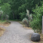
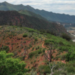
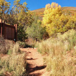
Connects: Rio Blanco County Road 10, South Fork Campground, Spring Cave Meeker, CO – Medium – 0.6 Miles – Hike, Run, Horseback Ride, Dog Friendly – Dirt Spring Cave Trail #1834 is an intermediate/moderate trail you can hike, run, and…

Spring Cave Trail
Posted in 1-3 Miles, Dirt, Dog Friendly, Hiking, Horseback Riding, Less Than A Mile, Medium, Meeker, Moderate, Running, Trails
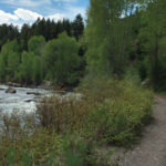
Spring Creek Trail
Connects: East Elk Creek Trail (Centennial Trail) New Castle, CO – Medium – 5.8 Miles – Hike, Run, Horseback Ride, Dog Friendly – Dirt Spring Creek Trail #2068 is an intermediate/moderate trail you can hike, run, and horseback ride that…
Posted in 4-7 Miles, 6 Miles, Dirt, Dog Friendly, Hiking, Horseback Riding, Medium, Moderate, New Castle, Rifle, Trails
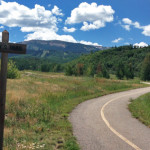
Spring Valley Loop

Connects: Red Canyon Road (CR 115), Kindall Road (CR 119), CMC Road (CR 114), Rio Grande Trail Carbondale, Glenwood Springs, CO – Medium – 13.6 Miles – Run, Road Bike, Mountain Bike – Gravel/Paved Spring Valley Loop is an intermediate/moderate…
Squirrel Trail
Connects: Rifle Falls State Park, Coyote Trail More information about the Rifle Falls State Park can be found at: Colorado Parks & Wildlife – Rifle Falls Trails Squirrel Trail Map Rifle Falls State Park View Larger Map
Posted in 1-3 Miles, 2 Miles, Dirt, Dog Friendly, Easy, Hiking, Rifle, Rifle Falls State Park, Running, Trails
Stairway to Heaven Trail

Connects: Colorow Trail New Castle, CO – Medium – 1 Mile – Hike, Run, Mountain Bike, Dog Friendly – Dirt The Stairway to Heaven Trail is an intermediate/moderate trail you can hike, run and mountain bike that is dog friendly.…
Posted in 1 Mile, 1-3 Miles, Dirt, Dog Friendly, Hiking, Medium, Moderate, Mountain Biking, New Castle, Running, Trails
Stark’s Trail
Connects: Owl Creek Trail, Powerline Trail, Tom Blake Trail Snowmass Village, CO – Easy – 1.24 Miles – Walk, Hike, Run, Mountain Bike, Dog Friendly – Paved/Dirt Stark’s Trail is an easy trail you can walk, hike, run, and bike…
Posted in 1 Mile, 1-3 Miles, Dirt, Dog Friendly, Easy, Paved, Running, Snowmass Village, Trails, Walking Tagged with: Starks Powerline
Stein Trail
Connects: ABC Trail, Stein Bridge, Rio Grande Trail, Stein Falls, Double Bar X Ranch Nature Preserve (Private) Aspen, CO – Easy – 0.6 Miles – Hike, Run, Mountain Bike, Horseback Ride, Dog Friendly – Dirt Stein Trail is an easy…
Posted in 1-3 Miles, Aspen, Dirt, Dog Friendly, Easy, Hiking, Horseback Riding, Less Than A Mile, Mountain Biking, Running, Trails
Stevie Bob Trail
Connects: Wulfsohn Mountain Park, Wulfsohn Trail, Vanderhoofin’ It Trail, Wulfsohn Road Glenwood Springs, CO – Medium – 1.2 Miles – Hike, Run, Mountain Bike, Dog Friendly – Dirt Stevie Bob Trail is an intermediate/moderate trail you can hike, run, and…
Posted in 1 Mile, 1-3 Miles, Dirt, Dog Friendly, Glenwood Springs, Hiking, Medium, Moderate, Mountain Biking, Running, Trails, Wulfsohn Mountain Park
Storm King Fourteen Memorial Trail
Glenwood Springs, CO – Medium – 2 Miles – Hike – Dirt The Storm King Fourteen Memorial Trail is an intermediate/moderate trail you can hike. The trail is in memory of the 14 firefighters who died there during the South…
Posted in 1 Mile, 1-3 Miles, Glenwood Springs, Hiking, Historic, Medium, Moderate, Trails Tagged with: South Canyon Fire, South Canyon Memorial Trail, Storm King Mountain Memorial Trail
Sugar Bowls Trail
Connects: Buttermilk Summer Road, Buttermilk Trail, West Buttermilk Warming Hut, West Buttermilk Trail, Government Trail Aspen, CO – Hard – 1.7 Miles – Hike, Run, Mountain Bike, Dog Friendly – Dirt The Sugar Bowls Trail is a difficult trail you…
Posted in 1-3 Miles, 2 Miles, Aspen, Buttermilk Mountain, Difficult, Dirt, Dog Friendly, Hard, Hiking, Mountain Biking, Running, Trails Tagged with: Buttermilk Bowl Trail, Buttermilk Bowls Trail, Sugar Bowl Trail, Sugarbowl Trail
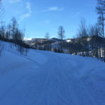
Sun King Uphill Route
Glenwood Springs, CO – Hard – 1.5 Miles – Uphill, Snowshoe – Snow Sun King Uphill Route is a difficult route you can skin and snowshoe up. This is a 1.5 mile uphill route on Sunlight Mountain in Glenwood Springs,…
Posted in 1 Mile, 1-3 Miles, Difficult, Glenwood Springs, Hard, Skinning, Snow, Snowshoeing, Trails, Uphilling (SkiMo), Winter Trail Tagged with: Sunlight Mountain
Sunlight to Powderhorn Trail (SP Trail)
Connects: Marion Cemetery Road (CR 123), Marion Cemetery, Marion Gulch Trail, Sunlight Mountain, Four Mile Road (FSR #300), Powderhorn Mountain Carbondale, Glenwood Springs, Grand Junction, CO – 120 Miles – Difficulty Varies – Snowshoe, Classic XC Ski – Snow The…
Posted in 8-10+ Miles, Carbondale, Classic XC Skiing, Glenwood Springs, Large Loops/Backpacking, Medium, Moderate, More Than 10 Miles, Nordic (XC Ski), Nordic Trail, Skate Skiing, Snow, Snowshoeing, Sunlight Mountain Resort, Sunlight Mountain Resort, Trails, Winter Trail Tagged with: Sunlight to Powderhorn Trail System, Sunlight-to-Powderhorn
Sunnyside Trail
Connects: Rio Grande Trail, McLain Flats Road (CR 19), Gold Butte Trail, Shadyside Trail, Red Mountain Road (FSR #130.3), Secret Trail, Plunge Trail, Hunter Creek Trail Aspen, CO – Medium – 10 Miles – Hike, Run, Mountain Bike, Horseback Ride,…
Posted in 10 Miles, 8-10+ Miles, Aspen, Dog Friendly, Hiking, Horseback Riding, Medium, Moderate, Mountain Biking, Running, Trails Tagged with: Leaf Peeping, Most Popular, Sunny Side Trail
Tabor Creek Trail
Connects: Lincoln Creek Road (FSR #106), Tabor Lake (12,310 ft) Aspen, CO – Medium – 3.9 Miles – Hike, Run, Horseback Ride, Dog Friendly – Dirt Tabor Creek Trail #2185, also called the Tabor Lake Trail, is an intermediate/moderate difficulty…
Posted in 4 Miles, 4-7 Miles, Aspen, Dirt, Hiking, Horseback Riding, Independence Pass, Medium, Moderate, Running, Trails Tagged with: Tabor Lake Trail


