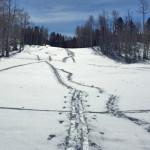
Connects: West Buttermilk Lift Aspen, CO – Medium – Uphill, Snowshoe – Snow West Buttermilk Uphill Route is a moderate route you can skin and snowshoe up. This is not a designated uphill route during the Aspen/Snowmass ski season. This…

Connects: West Buttermilk Lift Aspen, CO – Medium – Uphill, Snowshoe – Snow West Buttermilk Uphill Route is a moderate route you can skin and snowshoe up. This is not a designated uphill route during the Aspen/Snowmass ski season. This…
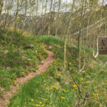
Connects: Buford-New Castle Road (FSR #245), Gravel Pit, Forest Service Road #819 New Castle, CO – Medium – Hike, Run, Mountain Bike, Horseback Ride, Dog Friendly – Dirt West Elk Trail #2290 is an intermediate/moderate trail you can hike, run,…
Connects: Maroon Creek Road (CR 13), West Maroon Wilderness Portal, Maroon Creek Trail (Maroon Bells), Maroon Lake (9,585 ft), Maroon Bells Scenic Trail, Maroon-Snowmass Trail, Crater Lake Trail Aspen, CO – Medium – 1 Mile – Hike, Run, Horseback Ride,…
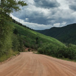
Connects: Sopris Creek Road (CR 7), East Sopris Creek Road (CR 7), BLM Road 8325, Dinkle Lake Road (FSR #311), The Crown, Prince Creek, Prince Creek Road (CR 5) Basalt, Carbondale, CO – Medium – 5.6 Miles – Road Bike,…
Connects: Rio Grande Trail, Hannon Creek Trail, Woody Creek Trail, Larkspur Mountain Road (FSR #103) Woody Creek, CO – Medium – 8.8 Miles – Run, Mountain Bike – Paved/Dirt Woody Creek Road (CR 18) is an intermediate/moderate road you can…
Connects: Woody Creek Road (CR #18), Larkspur Mountain Road (FSR #103), Spruce Creek Trail, Deer Park, Slab Park, Midway Creek Trail, Hunter Creek Trail Woody Creek, CO – Medium – 9.7 Miles – Hike, Run, Horseback Ride, Dog Friendly –…
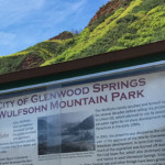
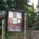
Connects: Glenwood Springs Whitewater Park, Midland Avenue Trail, Defiance Trail, Olson Trail, Stevie Bob Trail, Vanderhoofin’ It Trail, Wulfsohn Road, Wulfsohn Trail Glenwood Springs, CO – Recreation Area Wulfsohn Mountain Park is a 215 acre open space above the Glenwood…


