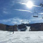
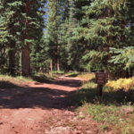
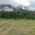
Glenwood Springs, CO – Hard – 1.5 Miles – Uphill, Snowshoe – Snow Sun King Uphill Route is a difficult route you can skin and snowshoe up. This is a 1.5 mile uphill route on Sunlight Mountain in Glenwood Springs,…

Glenwood Springs, CO – Hard – 1.5 Miles – Uphill, Snowshoe – Snow Sun King Uphill Route is a difficult route you can skin and snowshoe up. This is a 1.5 mile uphill route on Sunlight Mountain in Glenwood Springs,…
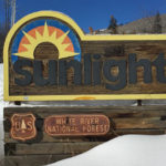
Connects: Babbish Trail, Babbish Express Trail, Compass Peak (9,895 ft), Compass Trail, Dippsy Doodle Trail, Garl’s Landing, Glades Trail, Grizzly Summer Road, High Places Chapel, Holiday Hill Trail, Leonard’s Lookout, Little Beaver Trail, Old Four Mile Road, Sun King Uphill…
Connects: Four Mile Road (FSR #300), Sunlight Peak (10,574 ft) View Larger Map
Connects: Marion Cemetery Road (CR 123), Marion Cemetery, Marion Gulch Trail, Sunlight Mountain, Four Mile Road (FSR #300), Powderhorn Mountain Carbondale, Glenwood Springs, Grand Junction, CO – 120 Miles – Difficulty Varies – Snowshoe, Classic XC Ski – Snow The…
Connects: Rio Grande Trail, McLain Flats Road (CR 19), Gold Butte Trail, Shadyside Trail, Red Mountain Road (FSR #130.3), Secret Trail, Plunge Trail, Hunter Creek Trail Aspen, CO – Medium – 10 Miles – Hike, Run, Mountain Bike, Horseback Ride,…
Connects: VIX Ranch Park, VIX Ranch Bike Park New Castle, CO – Easy – Hike, Run, Mountain Bike, Dog Friendly – Dirt The Sunset Trail is an easy trail you can hike, run, and mountain bike that is dog friendly.…
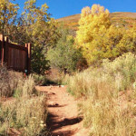
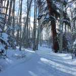
Connects: Lower Sunshine Trail, Tenderfoot Trail, Old Four Mile Road, Sunlight Backcountry Cabin, Williams Trail, Babbish Trail Glenwood Springs, CO – Easy – Snowshoe, Classic XC Ski, Dog Friendly – Snow Sunshine Trail is an easy winter trail you can…
Connects: Lincoln Creek Road (FSR #106), Tabor Lake (12,310 ft) Aspen, CO – Medium – 3.9 Miles – Hike, Run, Horseback Ride, Dog Friendly – Dirt Tabor Creek Trail #2185, also called the Tabor Lake Trail, is an intermediate/moderate difficulty…
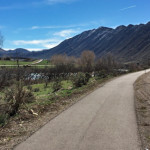
Connects: Colorado River, Flat Tops Bridge, Coal Ridge Park, Fire Mountain Disc Golf Course, Apple Tree Park New Castle, CO – Easy – 1.75 Miles – Walk, Run, Road Bike, Dog Friendly – Paved The Talbott Trail is an easy…
Connects: Red Table Road (FSR #514), Red Table Trail Basalt, CO – Medium – 6 Miles – Hike, Run, Mountain Bike, Horseback Ride, Dog Friendly – Dirt Taylor Creek Road (FSR #510) is an intermediate/moderate road you can hike, run,…
Connects: Burnt Mountain Road (FSR #506), Woods Lake Trail, Tellurium Lake (10,570 ft), Last Chance Trail, Josephine Lake Trail, Coffeepot Park (10,550 ft), Henderson Park (10,390 ft), Henderson Park Trail Thomasville, CO – Medium – 6.8 Miles – Hike, Run,…
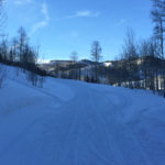
Connects: Sunlight Mountain, Chair Lift 2, Holiday Hill Trail, Old Four Mile Road Glenwood Springs, CO – Easy – Snowshoe, Classic XC Ski, Dog Friendly – Snow Tenderfoot Trail is an easy winter trail you can snowshoe and classic cross-country…
Connects: Tom Blake Equestrian Trail, Owl Creek Trail, Hahnenkamm Downhill, Anaerobic Nightmare Trail Snowmass Village, CO – Hard – 2 Miles – Snowshoe, Classic XC Ski, Skate Ski – Snow The Terminator Trail is a difficult winter trail you can…
Connects: Highway 133 (West Elk Loop Scenic Byway), Penny Hot Springs, The Narrows Carbondale, CO – Hard – Hike – Rocky The Narrows Trail is a difficult trail you can hike that leads to the climbing area known as The…
Connects: Dinkle Lake Road, Mount Sopris Trail, Hay Park Trail, Thomas Lakes (10,200 ft) Basalt, Carbondale, CO – Medium – 3.6 Miles – Hike, Run, Mountain Bike, Dog Friendly – Dirt Thomas Lakes Trail #1958 is an intermediate/moderate trail you…


