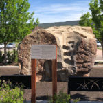
Connects: Carbondale Recreation and Community Center Carbondale, CO – Climbing The Carbondale Climbing Boulder is a large rock feature next to the Carbondale Recreation and Community Center in Carbondale, CO. View Larger Map

Connects: Carbondale Recreation and Community Center Carbondale, CO – Climbing The Carbondale Climbing Boulder is a large rock feature next to the Carbondale Recreation and Community Center in Carbondale, CO. View Larger Map
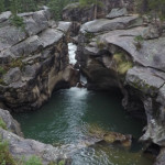
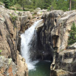
Connects: Independence Pass Road (HWY 82), Roaring Fork River Aspen, CO – Rocky Area The Devil’s Punchbowl, a popular cliff jumping spot, is a section of large rocks where water pools along the Roaring Fork River near Independence Pass just…
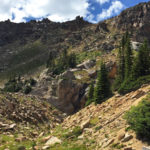
Connects: Maroon Bells-Snowmass Wilderness Marble, CO – Rocky Area The Devils Rockpile (10,702 ft) is a pillar class geographic survey feature in the Maroon Bells-Snowmass Wilderness of the White River National Forest near Marble, CO. More information about the Devils…
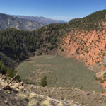
Connects: BLM Road 8460 Dotsero, CO – Rock The Dotsero Crater is a volcano, Colorado’s youngest volcano, where a large crater can be found. The Dotsero Volcano’s last eruption was just 4,200 years ago. This is a crater in Dotsero,…
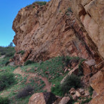
Connects: Roaring Fork Gorge, Gold Butte Trail Aspen, CO – Rocky Area Gold Butte is a rock with climbing routes accessed by the Gold Butte Trail in Aspen, CO. More information about climbing routes can be found at: Pitkin County…
Connects: Colorado Midland Trail (Hagerman Tunnel Trail), Douglass City, Opal Lake (11,390 ft), Hagerman Lake (11,330 ft) Leadville, CO – Historic Hagerman Tunnel is an old trail tunnel between Leadville and Basalt, CO. The tunnel was the highest railroad tunnel…
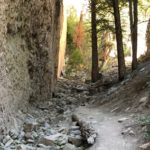
Connects: Lincoln Creek Road (FSR #106) Aspen, CO – Rocky Area The Lincoln Creek Grottos is a section of large rocks where water pools along Lincoln Creek off Lincoln Creek Road (FSR #106). Distances: Independence Pass Road (HWY 82)/Lincoln Creek…
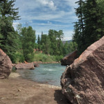
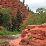
Connects: Highway 133 (West Elk Loop Scenic Byway), Crystal River, Redstone Campground Redstone, CO – Rocky Area The Redstone River Boulders offer climbing with access to the Crystal River. This is a site where various boulders sit off Highway 133…
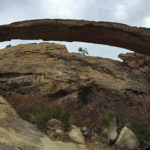
Connects: Rifle Arch Trail Rifle, CO – Rock Rifle Arch (6,580 ft) is a 60 foot high, 150 foot wide stone arch that rises off the Grand Hogback accessed by the Rifle Arch Trail in Rifle, CO. News about Rifle…
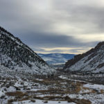
Connects: Highway 325, Rifle Gap State Park, Lakeview Campground, Cedar Campground, Pinyon Campground, Sage Campground Rifle, CO – Rock Rifle Gap is a narrow pass through the Grand Hogback that goes to Rifle Gap State Park located 10 miles off…
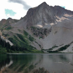
Connects: Maroon Bells-Snowmass Wilderness Snowmass, CO – Mountain Peak Snowmass Peak (13,627 ft) is a peak in the Maroon Bells-Snowmass Wilderness of the White River National Forest near Snowmass, CO. More information about Snowmass Peak can be found at: Wikipedia…
Connects: Fryingpan River, Frying Pan Road (CR 104), Old Wagon Road, Toner Creek Road Basalt, CO – Rock Strawberry Rock is a rock on the Fryingpan River with a short dirt path to the big rock. This is a site…
Connects: Thompson Creek Trail Carbondale, CO – Climbing The Thompson Creek Climbing Area is a section of rock with routes for climbing near Carbondale, CO. Thompson Creek is an Area of Critical Environmental Concern (ACEC). This area is currently access…


