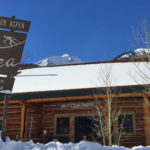
Connects: Castle Creek Road (CR 15), Express Creek Road (FSR #122), Ashcroft Ghost Town Ashcroft, CO – Difficulty Varies – Distance Varies – Snowshoe, Classic XC Ski, Skate Ski – Snow The Ashcroft Ski Touring Trails are a privately owned…

Connects: Castle Creek Road (CR 15), Express Creek Road (FSR #122), Ashcroft Ghost Town Ashcroft, CO – Difficulty Varies – Distance Varies – Snowshoe, Classic XC Ski, Skate Ski – Snow The Ashcroft Ski Touring Trails are a privately owned…
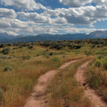
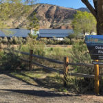
Connects: Frying Pan Road (CR 104), Basalt Shooting Range, Hillside Trail, Kelly Lake Road, Lake Christine, Micro Hydro Power Plant Road, Midvalley View Trail, Old Wagon Road, Toner Creek Road Basalt, CO – Wildlife Area The Basalt State Wildlife Area…
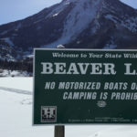
Connects: Aspen to Marble, Marble to Crested Butte, Gunnison County Road 3, Beaver Lake Trail, Crystal River Marble, CO – Lake Beaver Lake (7,945 ft), also a State Wildlife Area, is a lake along Gunnison County Road 3 in Marble,…
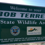
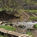
Connects: Carbondale (6,180 ft), Roaring Fork River, Highway 82, Highway 133 (West Elk Loop Scenic Byway), Red Hill, Veterans Memorial Bridge Carbondale, CO – Wildlife Area The Bob Terrell State Wildlife Area, formerly the Koziel Boat Launch and commonly referred…
Connects: Prince Creek Road (CR 5, 111), Prince Creek Trail Carbondale, CO – Recreation Area The Bull Pen is a future parking lot for access to the Prince Creek trails and The Crown. The project is slated to be completed…
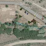
Connects: Dotsero (6,150 ft), Interstate 70, Dotsero Bridge Dotsero, CO – Recreation Area The Dotsero Landing is a recreation area along the Upper Colorado River near I-70 in Dotsero, CO. More information about Dotsero Landing can be found at: Aspen…
Connects: Arbaney Traverse, Sunnyside Trail, Secret Trail (Sunnyside Trail), Hobbit Trail, Lenado Trail (Tincup/Tinpot Trail), Four Corners Road (20B.1), Van Horn Trail, Red Mountain Road (FSR #130.3) Aspen, CO – Recreation Area Four Corners (9,785 ft) is a trail intersection…
Connects: Garfield Creek Road (CR 312), Baldy Creek Road (CR 328) New Castle, CO – Wildlife Area The Garfield Creek State Wildlife Area is an area near New Castle, CO. The area consists of two separate units: Garfield Creek and…
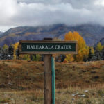
Connects: High School Trail, Aspen High School Trails (Winter) Aspen, CO – Crater Haleakala Crater is a cratered area, created by a berm between the Meadowood neighborhood and the high school, with trails near the Aspen High School in Aspen,…
Connects: Larkspur Mountain Road (FSR #103), Kobey Park Road (FSR #508), Kobey Trail Lenado, CO – Recreation Area Kobey Park (10,990 ft) is an old historic logging area above Woody Creek, near Lenado, with many spur roads. The area offers…
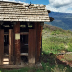
Connects: Scout Trail, Lookout Mountain Road (CR 120) Glenwood Springs, CO – Viewing Area Lookout Mountain Park (7,950 ft) is a site that includes picnic tables and a historic outhouse at the bottom of the radio towers on Lookout Mountain…
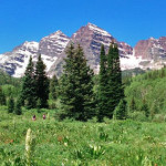
Connects: Maroon Creek Road (CR 13), Maroon Lake (9,585 ft), Maroon Bells Scenic Trail, Maroon Creek Trail (Maroon Bells), Four Pass Loop, Crater Lake Trail, Maroon-Snowmass Trail Aspen, CO – Recreation Area The Maroon Bells Scenic Area is an open…
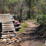
Connects: Prince Creek, Monte Carlo Trail Carbondale, CO – Recreation Area The Monte Carlo Bike Ramp is an old car turned into a bike obstacle that gives the trail it’s found on its name, Monte Carlo Trail. This is a…
Connects: The Crown, BLM Road 8320, BLM Road 8324, BLM Road 8325, Christmas Tree Trail, Creekside Trail, English Trim Trail, Father of Ginormous Trail (Downhill Only), Ginormous Trail, Highline Trail, Innie Trail, Monte Carlo Trail, Monte Carlo Bike Ramp, Outie…
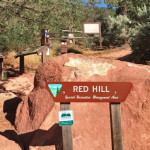
Connects: Carbondale (6,180 ft), Red Hill Road (CR 107), Blue Ribbon Trail, Bogus Trail, Elk Traverse Trail, Faerie Trail, Mushroom Rock Trail, Northside Loop Trail, Outer Loop Trail, Roller Coaster Trail, Sage Loop Trail, Skeeter’s Ridge Trail, Three Gulch Trail,…


