Babbish Trail

Babbish Trail

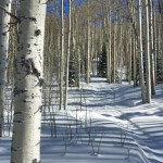
Connects: Sunlight Mountain, Sunlight Backcountry Cabin, Sunshine Trail, Old Four Mile Road, Williams Trail, Glades Trail, Upper Meadows Loop Trail, Sunlight Shelter Glenwood Springs, CO – Hard – Snowshoe, Classic XC Ski, Dog Friendly – Snow Babbish Trail is a

Posted in Classic XC Skiing, Difficult, Dog Friendly, Glenwood Springs, Hard, Nordic (XC Ski), Nordic Centers and Systems, Nordic Trail, Snow, Snowshoeing, Sunlight Mountain Resort, Trails, Winter Trail

Big Burn Uphill Route

Big Burn Uphill Route

Connects: Big Burn Lift Snowmass Village, CO – Hard – 3.4 Miles – Uphill, Snowshoe, Dog Friendly – Snow Big Burn Uphill Route is a difficult route you can skin and snowshoe up that is dog friendly. This is an

Posted in 1-3 Miles, 3 Miles, Difficult, Dog Friendly, Hard, Skinning, Snow, Snowmass Village, Snowshoeing, Trails, Uphilling (SkiMo), Winter Trail

Big Dipper Trail (XC Only)

big dipper trail

Connects: Spring Gulch, Wagon Road Trail (XC Only), Sidewinder Trail (XC Only), Highball Trail (XC Only) Carbondale, CO – Hard – 0.75 KM (0.46 Miles) – Classic XC Ski, Skate Ski – Snow Big Dipper Trail is a difficult winter

Posted in 1-3 Miles, Carbondale, Classic XC Skiing, Difficult, Hard, Less Than A Mile, Nordic (XC Ski), Skate Skiing, Snow, Trails, Winter Trail

Blue Lake Trail

Blue Lake Trail

Connects: North Fork Trail, Blue Lake (12,500 ft) Aspen, CO – Hard – 2.2 Miles – Hike, Run, Dog Friendly – Dirt Blue Lake Trail is a difficult trail you can hike and run that is dog friendly. This is

Posted in 1-3 Miles, 2 Miles, Aspen, Difficult, Dirt, Dog Friendly, Hard, Hiking, Mount Massive Wilderness, Rocky, Running, Trails

Blue Ribbon Trail

Blue Ribbon Trail

Connects: Red Hill, Three Poles Trail, Mushroom Rock Trail, Bogus Trail, Three Gulch Trail Carbondale, CO – Hard – 1.2 Miles – Hike, Run, Mountain Bike, Dog Friendly – Dirt Blue Ribbon Trail is a difficult trail you can hike,

Posted in 1 Mile, 1-3 Miles, Carbondale, Difficult, Dirt, Dog Friendly, Hard, Hiking, Mountain Biking, Red Hill, Running, Trails

Boy Scout Loop

Connects: Scout Trail, Forest Hollow Trail, Hubbard Cave Road (FSR #408), Lookout Mountain Road (CR 120), Red Canyon Road (CR 115), Rio Grande Trail Glenwood Springs, CO – Hard – 18+ Miles – Hike, Run, Mountain Bike, Dog Friendly –

Posted in 8-10+ Miles, Difficult, Dirt, Dog Friendly, Glenwood Canyon, Glenwood Springs, Hard, Hiking, Large Loops/Backpacking, Lookout Moutain, More Than 10 Miles, Mountain Biking, Running, Trails

Buttermilk Trail

Buttermilk Trail

Connects: Buttermilk Connector Trail, Buttermilk Summer Road, Oregon Trail, Government Trail, Tiehack Trail, Tiehack Summer Road Aspen, CO – Hard – 2 Miles – Hike, Run, Dog Friendly – Dirt The Buttermilk Trail is a difficult trail you can hike

Posted in 1-3 Miles, 2 Miles, Aspen, Buttermilk Mountain, Difficult, Dirt, Dog Friendly, Hard, Hiking, Running, Trails

Capitol Creek Trail

Capitol Creek Trail

Connects: Capitol Creek Road (CR 9), Nickelson Creek Trail, Upper Capitol Creek Trail, Avalanche Creek Trail, West Snowmass Trail, Capitol Lake (11,600 ft) View Larger Map

Posted in 4-7 Miles, 7 Miles, Classic XC Skiing, Difficult, Dirt, Dog Friendly, Hard, Hiking, Horseback Riding, Maroon Bells-Snowmass Wilderness, Nordic (XC Ski), Old Snowmass, Running, Snow, Snowshoeing, Winter Trail Tagged with: , , , ,

Carbondale to Crested Butte

Crystal Valley Trail

Connects: Highway 133 (West Elk Loop Scenic Byway), Crystal Valley Trail, Redstone (7,200 ft), Marble (8,000 ft), McClure Pass (8,755 ft), Kebler Pass (10,007 ft) Carbondale, CO – Hard – 74 Miles – Hike, Run, Mountain Bike, Horseback Ride, Dog

Posted in 8-10+ Miles, Carbondale, Crested Butte, Difficult, Dirt, Dog Friendly, Hard, Hiking, Horseback Riding, Large Loops/Backpacking, More Than 10 Miles, Mountain Biking, Paved, Road Biking, Running, Trails Tagged with: , , , ,

Castle/Conundrum Peak Trail

Connects: Montezuma Basin Road (FSR #102), Castle Peak (14,279 ft), Conundrum Peak (14,040 ft) Ashcroft, CO – Hard – Hike -Rocky The Castle/Conundrum Peak Trail is a difficult trail you can hike to Castle Peak (14,279 ft) and Conundrum Peak

Posted in 4-7 Miles, Ashcroft, Aspen, Difficult, Hard, Hiking, Rocky, Trails

Cathedral Lake Trail

Cathedral Lake Trail

Connects: Castle Creek Road (CR 15), Cathedral Lake (11,866 ft), Electric Pass Trail Aspen, CO – Hard – 2.8 Miles – Hike, Run, Horseback Ride, Dog Friendly – Dirt Cathedral Lake Trail #1984 is a difficult trail you can hike,

Posted in 1-3 Miles, 3 Miles, Ashcroft, Aspen, Difficult, Dirt, Dog Friendly, Hard, Hiking, Horseback Riding, Maroon Bells-Snowmass Wilderness, Trails Tagged with: , , ,

Compass Trail

Compass Trail

Connects: Sunlight Mountain, Babbish Express Trail, High Places Chapel, Compass Peak (9,895 ft) Glenwood Springs, CO – Hard – Snowshoe, Classic XC Ski, Dog Friendly – Snow Compass Trail is a difficult winter trail you can snowshoe and classic cross-country

Posted in Classic XC Skiing, Difficult, Dog Friendly, Glenwood Springs, Hard, Nordic (XC Ski), Nordic Centers and Systems, Nordic Trail, Snow, Snowshoeing, Trails, Winter Trail

Congo Trail

Congo Trail

Connects: Castle Creek Road (CR 15), Highlands Summer Road Aspen, CO – Hard – 1.7 Miles – Hike, Run, Mountain Bike, Dog Friendly – Dirt Congo Trail is a difficult trail you can hike, run, and mountain bike that is

Posted in 1-3 Miles, 2 Miles, Aspen, Difficult, Dirt, Dog Friendly, Hard, Hiking, Mountain Biking, Running, Trails Tagged with:

Continental Divide Trail (Independence Pass)

Continental Divide Trail

Connects: Independence Pass Road (HWY 82), Independence Pass (12,095 ft), Independence Pass Scenic Trail Aspen, CO – Hard – Hike, Run, Horseback Ride, Dog Friendly – Dirt/Rocky The Continental Divide Trail is a difficult trail you can hike, run, and

Posted in 8-10+ Miles, Aspen, Dirt, Dog Friendly, Hard, Hiking, Horseback Riding, Independence Pass, Rocky, Running, Trails

Cooper Creek Road (Iron Mine Road)

Cooper Creek Road

Connects: Castle Creek Road (CR 15), Montezuma Basin Road (FSR #102), Pearl Pass Road (FSR #102), Lindley Hut Distances: Bridge over Castle Creek to Lindley Hut – 1.8 Miles View Larger Map

Posted in Alfred A. Braun Hut System, Ashcroft, Aspen, Classic XC Skiing, Difficult, Dirt, Dog Friendly, Hard, Hiking, Horseback Riding, Mountain Biking, Nordic (XC Ski), Running, Snow, Snowshoeing, Trails, Winter Trail Tagged with: , , ,

Trail Search

Find a trail. Use 1 or all 4 drop downs to customize your search for the right trail.

Dog Friendly:

  or  

Park Search

Find a park. Use the drop downs to find the perfect park.

Dog Friendly:

  or  

Featured and Mentioned On

Questions? Email us at info@aspentrailfinder.com
By using this site you agree to the terms of our User Agreement. Read our Disclaimer.