East Creek/Gift Creek Trail

East Creek/Gift Creek Trail

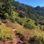
Connects: Boulders Trail, Lily Lake Trail, Avalanche Creek Trail

Posted in 8 Miles, 8-10+ Miles, Dirt, Dog Friendly, Expert, Hard, Hiking, Horseback Riding, Maroon Bells-Snowmass Wilderness, Medium, Moderate, Redstone, Snow, Snowshoeing, Trails, Winter Trail Tagged with: ,

Glenwood Canyon

Glenwood Canyon

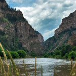
Connects: Glenwood Springs (5,760 ft), Colorado River, Glenwood Canyon Trail, Horseshoe Bend Park, Artist Point (6,540 ft), No Name Rest Area, No Name Trail (Jess Weaver Trail), No Name Canyon, Grizzly Creek Rest Area, Grizzly Creek Trail, Grizzly Creek Canyon,

Posted in 8-10+ Miles, Climbing, Difficult, Dirt, Dog Friendly, Dotsero, Easy, Expert, Glenwood Canyon, Glenwood Springs, Hard, Hiking, Horseback Riding, Medium, Moderate, Mountain Biking, Paved, Road Biking, Rocky, Running, Sites, Snow, Snowshoeing, Viewing Area, Walking Tagged with: , ,

Lead King Basin Road (FSR #315)

Lead King Basin Road

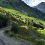
Connects: Gunnison County Road 3, Daniels Hill, Lead King Loop, North Lost Trail, Silver Creek Trail, Schofield Pass Road (FSR #317), Crystal City Road (FSR #314), Avalanche Pass Trail Marble, CO – Hard – Hike, Run, Mountain Bike, Horseback Ride,

Posted in 4-7 Miles, Difficult, Dirt, Dog Friendly, Expert, Hard, Hiking, Horseback Riding, Marble, Mountain Biking, Rocky, Running, Sheep Mountain, Trails Tagged with: , , , ,

Lost Man Loop

Lost Man Trail

Connects: Independence Pass Road (HWY 82), Lost Man Campground, Lost Man Trail, Midway Creek Trail, Lost Man Reservoir (10,580 ft) , South Fork Pass Trail, Lost Man Lake (12,450 ft), Lost Man Pass (12,805 ft), Independence Lake (12,497 ft), Linkins

Posted in 8-10+ Miles, Difficult, Dog Friendly, Expert, Hiking, Horseback Riding, Large Loops/Backpacking, More Than 10 Miles, Road Biking, Running, Trails

North Fork Cutoff Trail

North Fork Cutoff Trail

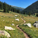
Connects: Four Pass Loop, Geneva Lake Trail, Fravert Basin Trail (North Fork Trail) Marble, CO – Hard – 1.1 Miles – Hike, Run, Horseback Ride, Dog Friendly – Rocky/Dirt North Fork Cutoff Trail is a difficult trail you can hike,

Posted in 1 Mile, 1-3 Miles, Difficult, Dirt, Dog Friendly, Expert, Hard, Hiking, Horseback Riding, Marble, Maroon Bells-Snowmass Wilderness, Rocky, Running, Trails

Schofield Pass Road (FSR #317)

Connects: Lead King Loop, Lead King Basin Road (FSR #315), Crystal City Road (FSR #314), Crystal Bridge No. 4, Devil’s Punchbowl (Schofield Pass), Schofield Park, West Maroon Trail, Schofield Pass (10,700 ft) Marble, CO – Hard – 8 Miles –

Posted in 8 Miles, 8-10+ Miles, Crested Butte, Difficult, Dog Friendly, Expert, Hard, Hiking, Marble, Mountain Biking, Rocky, Running, Trails Tagged with: , , ,

Trail Search

Find a trail. Use 1 or all 4 drop downs to customize your search for the right trail.

Dog Friendly:

  or  

Park Search

Find a park. Use the drop downs to find the perfect park.

Dog Friendly:

  or  

Featured and Mentioned On

Questions? Email us at info@aspentrailfinder.com
By using this site you agree to the terms of our User Agreement. Read our Disclaimer.