Lead King Loop

1 Star2 Stars3 Stars4 Stars5 Stars6 Stars7 Stars8 Stars9 Stars10 Stars (95 votes, avg: 9.38 out of 10)
Loading...

Connects: Aspen to Marble, Marble to Crested Butte, Daniels Hill, Lead King Basin Road (FSR #315), North Lost Trail, Avalanche Pass Trail, Arkansas Mountain Trail, Silver Creek Trail, Schofield Pass Road (FSR #317), Crystal City Road (FSR #314), Crystal City (Town of Crystal), Crystal Mill, Lizard Lake

Aspen Trail Finder Hiking TrailsAspen Trail Finder Running TrailsAspen Trail Finder Mountain Biking Trailshorse friendly trailDog_Paw_Icon_48

Lead King Loop

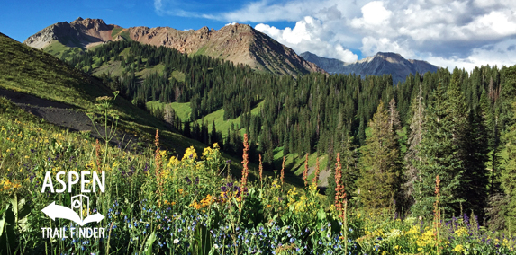
Lead King Loop connecting FSR #315 & #314 in Marble

Lead King Loop Trail MapLead King Loop Trail Map

Marble, CO – Hard – 13 Miles – Hike, Run, Mountain Bike, Horseback Ride, Dog Friendly – Dirt

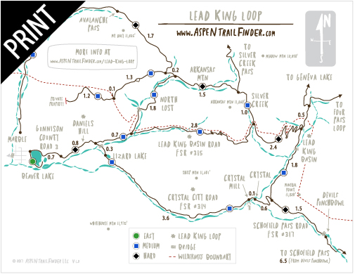
The Lead King Loop is a 13 mile dirt road connection using Lead King Basin Road (FSR #315) and Crystal City Road (FSR #314) around Sheep Mountain. You can hike, run, mountain bike, and horseback ride this dog friendly jeep road. This is a dirt loop near Marble, CO.

More information about the Lead King Loop can be found at:
White River National Forest – Lead King Basin Loop Road #315 & #314 (4WD)
Lead King Loop Charity Races – www.leadkingloop25k.com


View Larger Map

Comments

Subscribe
Notify of
guest
0 Comments
Inline Feedbacks
View all comments
Posted in 8-10+ Miles, Dirt, Dog Friendly, Hard, Hiking, Horseback Riding, Large Loops/Backpacking, Marble, More Than 10 Miles, Mountain Biking, Running, Sheep Mountain, Trails Tagged with: ,

By using this site you agree to the terms of our User Agreement. Read our Disclaimer.

Trail Search

Find a trail. Use 1 or all 4 drop downs to customize your search for the right trail.

Dog Friendly:

  or  

Park Search

Find a park. Use the drop downs to find the perfect park.

Dog Friendly:

  or  

Featured and Mentioned On

Questions? Email us at info@aspentrailfinder.com
By using this site you agree to the terms of our User Agreement. Read our Disclaimer.