(50 votes, avg: 9.24 out of 10)
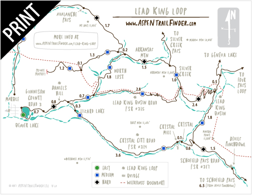
Connects: Gunnison County Road 3, Daniels Hill, Lead King Loop, Schofield Pass Road (FSR #317), Lead King Basin Road (FSR #315), Lizard Lake, Legend of Tall Tree Trail, Crystal Mill, Crystal City (Town of Crystal)
![]()
![]()
![]()
![]()
![]()
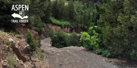
The rough Crystal City Road (FSR #314) in Marble
Marble, CO – Medium – 5.5 Miles – Hike, Run, Mountain Bike, Dog Friendly – Rocky
The Crystal City Road (FSR #314) is an intermediate/moderate road you can hike, run and mountain bike that is dog friendly. This road winds up from Marble, through the ghost town of Crystal, and past the Devil’s Punchbowl near Schofield Pass. This is a rocky road near Marble, CO.
Distances:
Top of Daniels Hill (FSR #314 & #315 split) to Crystal City (Town of Crystal) – 4 miles
More information can be found at:
White River National Forest – Crystal City Road #314 (4WD)
White River National Forest – Lead King Basin Loop Road #315 & #314 (4WD).