


 (7 votes, avg: 8.43 out of 10)
Connects: Rifle Creek Road (CR 217), Koper’s Trail, Lower Ice Cave, Upper Ice Cave
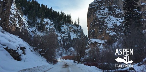
Rifle Creek Road (CR 217) through Rifle Mountain Park
Rifle, CO – Recreation Area
To get to the park from downtown Rifle, take Railroad Avenue (which becomes Highway 13) north through the city. Take a right on Hwy 325, toward Rifle Creek Golf Course and Rifle Gap Reservoir. Drive past the dam at Rifle Gap and continue on Hwy 325 toward Rifle Falls. Pass Rifle Falls and shortly after the Rifle Fish Hatchery, the road will then become gravel after the fish hatchery. The entrance to Rifle Mountain Park, a self-pay station where you can purchase a parking pass, is less than 0.35 miles up the road.
News about Rifle Mountain Park can be found at:
Post Independent (January 7, 2015) – Go Play: Ice caves at Rifle Mountain Park a winter jewel for many
More information can be found at:
City of Rifle – Rifle Mountain Park


