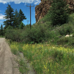
Eagle-Thomasville Road (FSR #400)

Eagle-Thomasville Road

Connects: Frying Pan Road (CR 104), Spring Creek Ridge (FSR #519), Lime Park (9,300 ft), Burnt Mountain Road (FSR #506), Crooked Creek Reservoir (9,415 ft), Crooked Creek Pass (10,000 ft), Mount Thomas Trail, Sylvan Lake State Recreation Area Thomasville, CO

Posted in 8-10+ Miles, Basalt, Dirt, Dog Friendly, Eagle, Easy, Hiking, Horseback Riding, Meredith, More Than 10 Miles, Mountain Biking, Ruedi Reservoir, Running, Trails Tagged with:

Trail Search

Find a trail. Use 1 or all 4 drop downs to customize your search for the right trail.

Dog Friendly:

  or  

Park Search

Find a park. Use the drop downs to find the perfect park.

Dog Friendly:

  or  

Featured and Mentioned On

Questions? Email us at info@aspentrailfinder.com
By using this site you agree to the terms of our User Agreement. Read our Disclaimer.