Connects: Lower Valley Trail (LoVa Trail), South Canyon, South Canyon Bridge, South Canyon Archery Range, Tramway Trail, South Canyon Hot Springs, South Canyon Landfill, South Canyon Sledding Hill (Winter)
![]()
![]()
![]()

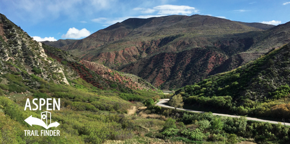
South Canyon Creek Road from the South Canyon Hot Springs
Glenwood Springs, CO – Medium – Road Bike, Mountain Bike – Paved/Dirt
South Canyon Creek Road (CR 134) is an intermediate/moderate road you can bike. This is a road with the first mile paved to the South Canyon Landfill and the remaining section dirt.
To get to the Glenwood Springs South Canyon, travel west on Highway 70 and take Exit 111. After you exit, take the first left at the stop sign onto South Canyon Creek Road (CR 134).
News about the South Canyon can be found at:
Post Independent (March 17, 2018) – Construction begins on South Canyon bike trails network
Post Independent (January 19, 2018) – Offer emerges to develop Glenwood Springs’ So. Canyon hot springs site
Post Independent (January 15, 2006) – Glenwood aims to settle future of South Canyon
City of Glenwood Springs Park Lands
Firearms and other weapons prohibited by city ordinance
Dumping allowed only at city landfill
No camping permitted on city park lands
Please respect all park ordinances”
Overview
South Canyon is now known for its landfill, hot springs, and shooting range. However, since the beginning of white settlement, South Canõn (original spelling) was known for coal mining. While the coal quality is very good, the mine was plagued with fires that still burn today.
Today nature is slowly reclaiming the mining sites. These areas have a surprisingly wide variety of plant species due to the variable terrain and water seeps. The area is also recovering form the 2002 Coal Seam Fire that was ignited at a vent for the underground burning coal.
The Mines
South Canyon Mining Area (1885 – 1951) – These high quality coal deposits provided energy to Glenwood Springs beginning in 1885. In 1903 large scale mining began, utilizing an electric tram (*referred to as the “Lightning Bug”) to move coal 2 miles from the mines to the rail yard at the Colorado River. This operation ended in 1916 and the mine reopened in 1919 again for local domestic use.
Fires disrupted the operation periodically and eventually led to the final closure of the mines in 1951 and the abandonment of a few homes near the mine. Many foundations still exist from the homes, mining buildings and infrastructure. Other signs include debris, tailings piles, as well as subsidence and smoking vents of the underground burning coal.
The Town
Town (1902 – @1916) – The town contained a store, a dining hall with seating capacity for 100, a bunkhouse serving 150 men, a park with a bandstand, a baseball field, a church, a library, a town well, and about 37 cottages. Several of the foundations remain today.
The Rail Yard
South Canon Station (1903 – @1916) – The station consisted of the Colorado Midland Railroad yard, a tipple for loading coal from the electric tram into the rail car, an electric powerhouse, a post office (1905), an ice house, and other unknown buildings.
A ferry across the river was built in 1886 and then it was replaced with a bridge in 1915 that still stands today. The City of Glenwood Springs purchased 2,900 acres in South Canyon in (1958 *the date is unclear on the sign) and the bridge was placed on the National Register of Historic Places in 1985.”


