


Connects: Colorado River, Colorado River Trail, Rifle Boat Ramp, Rifle Ponds Wildlife Viewing Trail, Lion’s Park Circle, Middle Colorado Watershed Council
Rifle Rest Area Park near I-70
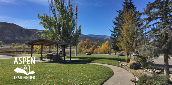
Rifle, CO – Park
The Rifle Rest Area Park is a CDOT Rest Area near I-70 in Rifle, CO. This park includes:
Shelters
Picnic Tables
Benches
Pond
River Access
Open Area
Restrooms
Do not drain water or sewage on grounds
Pets in pet area only
No overnight camping
No skateboarding, rollerblades, or bicycles on sidewalk
This is your park please help keep it clean”
During the U.S. Geological Survey of 1876, A.C. Peale wrote the word “rifle” on his map to mark the location fo a misplaced firearm. The gun was never found, but the name stuck. Founded in 1882, Rifle attracted a steady flow of settlers seeking good land and convenient railroad access; tourism emerged as a third staple after President Theodore Roosevelt’s well publicized 1905 Garfield County bear hunt. The twentieth century brought a series of brief mineral rushes –
the uranium used in the atomic blasts that ended World War II was processed near here – but Rifle avoided some of the boom-bust upheavals that rocked many neighboring towns. With its solid base of agriculture, hunting, and recreation, Rifle remains a community of sure and steady aim.
Bulgarian-born artist Christo called his creation “a pure and beautiful tribute to the imagination of man.” Local promoters hoped it would bring a windfall in tourism, but the public couldn’t decide whether it was a work of art or a $700,000 publicity stunt. From any standpoint, the 360-foot-high, quarter-mile-wide translucent orange curtain spanning Rifle Gap was a monumental undertaking. An initial attempt in October 1971 ended disastrously when gale-force winds shredded the fabric. The second attempt, on August 10, 1972, also hit a snag, but a worker’s high-wire heroics freed some tangled fabrics and allowed the unfurling to proceed. Christo’s Curtain hung for twenty-eight hours, long enough for the artist to declare triumph; then, inevitably, the canyon gusts asserted themselves, forcing a hasty dismantling.”
If oil is king, then oil shale is the heir apparent. -Victor C. Alderson, president, Colorado School of Mines, 1919
The First Boom
It didn’t glitter like gold, but oil shale promised to be every bit as valuable. Western Colorado had huge amounts of it – the equivalent of two trillion barrels of oil, geologists estimated – and when World War I created a sudden pinch in the fuel supply, the rush was on. Between 1916 and 1920 speculators filed thousands of claims in and around the Piceance Basin, and two hundred oil shale companies formed. However, refining oil shale was literally like wringing water from stone; the costs far exceeded the yield. As a result, this vast fortune stayed in the ground – there for the taking, yet absolutely unobtainable. By 1930 investors had seen enough of this maddening state of affairs, and the oil shale business hit rock bottom.
Black Sunday
Colorado had seen busts before, but the oil shale bust of 1982 was the first one caused by a corporate balance sheet. Soaring energy prices in the late 1970s had driven U.S. oil companies back to western Colorado’s petrified petroleum, and Rifle, Parachute, and neighboring communities briefly enjoyed the boom that had eluded them decades earlier. Then, unexpectedly, international oil prices sagged; though oil shale remained a recoverable, marketable resource, the expected profits were no longer there. On May 2, 1982 – “Black Sunday” – Exxon abruptly terminated its multimillion dollar project and fired 2,100 workers; by summer’s end the industry had collapsed, costing Garfield County thousands more jobs. Once again the oil shale windfall proved a mere mirage, vanishing without a trace.”


