

 (4 votes, avg: 9.25 out of 10)
Connects: Government Road (HWY 13), Rifle Arch (6,580 ft)
![]()
![]()
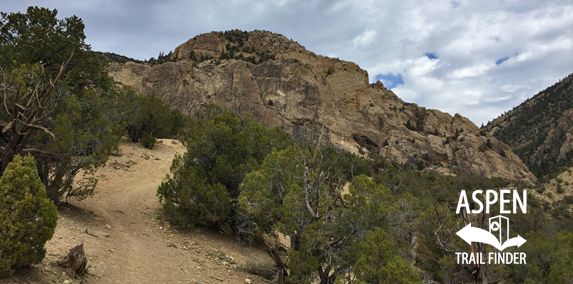
The Rifle Arch Trail in Rifle
Rifle, CO – Medium – 1.5 Miles – Hike – Dirt
Rifle Arch Trail is an intermediate/moderate trail you can hike. This is a 1.5 mile dirt trail to Rifle Arch (6,580 ft) in Rifle, CO.
To get to the trailhead from Downtown Rifle, travel north on Government Road (HWY 13) just passed mile marker 7. There is a parking area on the right with a small gate and a sign for the Rifle Arch Trailhead.
News about Rifle Arch Trail can be found at:
Post Independent (June 26, 2014) – Rifle Arch, trail offers views and more
More information about Rifle Arch Trail can be found at:
Bureau of Land Management (BLM) – Rifle Arch


The trail is pretty easy for the first 1.25 mile to a bench below Rifle Arch with a great view of the rock. To get in the actual arch, the last part is bouldering up some pretty loose rock and sand. There’s a trail, but it’s not particularly friendly.