


Connects: Basalt State Wildlife Area, Strawberry Rock, Old Wagon Road, Toner Creek Road, Frying Pan Spring, Rocky Fork Day Use Area, Toilet Bowl, Ruedi Reservoir, Ruedi Trail, Meredith (7,830 ft), Thomasville (7,980 ft), Thomasville Lime Kilns, Eagle-Thomasville Road (FSR #400), Montgomery Flats Trail, North Fork Road (FSR #501), Norrie (8,450 ft), Norrie Road (FSR #504), Chapman Campground, Chapman Reservoir (8,545 ft), Fryingpan Lakes Road (FSR #505), Hagerman Pass Road (FSR #105)
![]()
![]()
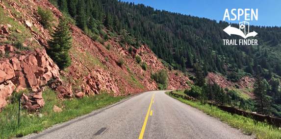
Frying Pan Road that winds through the Fryingpan Valley
Basalt, CO – Medium – 32 Miles – Road Bike – Paved
Frying Pan Road (CR 104) is an intermediate/moderate paved road you can road bike. This is a 32 mile paved road that goes through Basalt, Meredith, Thomasville, Norrie Colony, and Nast. The road becomes dirt at the Forest Service kiosk and intersection with Hagerman Pass Road (FSR #105) connecting Basalt and Leadville, CO.
Distances:
Basalt to Rocky Fork Day Use Area – 12.6 Miles
Basalt to Ruedi Reservoir – 13.5 Miles
Basalt to Ruedi Creek Campground and Boat Ramp / Ruedi Trail – 14.4 Miles
Basalt to Aspen Yacht Club – 18 Miles
Basalt to Freeman Mesa Day Use Area – 19.4 Miles
Basalt to Meredith / Dearhamer Campground – 21.6 Miles
Basalt to Thomasville Lime Kilns – 24.1 Miles
Basalt to Eagle-Thomasville Road (FSR #400) – 25 Miles
Basalt to North Fork Road (FSR #501) – 25.8 Miles
This area of Pitkin County was settled in the 1880s. The numerous settlements along the upper Frying Pan Valley area grew up around the route of the Colorado Midland Railroad. until 1885 the valleys of the Roaring Fork drainage were accessible only by foot, horse, and mule and the mineral wealth could not be fully realized until more efficient modes of transportation could be established. In the early 1880s, two railroads were in competition to reach the valley floor first and establish themselves to claim their share of the wealth. The Denver & Rio Grande Railroad, a narrow gauge railway, chose to extend its route from Leadville, through Glenwood Canyon alongside the Colorado River to Glenwood Springs. The Colorado Midland chose to extend its standard gauge line from Leadville by way of a tunnel through the Continental Divide connecting Leadville and the head of the Frying Pan Valley, then proceeding down to the Roaring Fork Valley Floor. The Denver & Rio Grande arrived in Aspen in October of 1887, ahead of Colorado Midland by only a few months.
The completed Colorado Midland Railroad was the only standard gauge route in the Colorado high country and traveled along the alignment of this road between Leadville and Basalt. The total length of the rail line was 261 miles. Depending in the era in which you traveled, it featured up to 18 tunnels of various lengths. The longest was almost 2 miles long while others were very short. The Hagerman Tunnel, which crossed under the Continental Divide, is 2,200 feel long and sits at over 11,000 feet above sea level. The construction of the route was an engineering marvel. The tunnels, bridges and the railroad bed were constructed by hundreds of men using dynamite, picks and shovels, summer and winter. Mules and wagons are the only form of transportation. Camps were established to support the workers and these camps quickly grew into established communities that lived on beyond the railroad construction.
These communities included Ruedi, which was located where the reservoir now sits, Meredith, Norrie, Sellar, and Nast, among some others. These communities had their own identities and niches, and thrived because of the Colorado Midland Railroad.
This sites was originally known as Calcium, named for the lime processing industry that was centered here once the railroad was established. The Lime Kilns, located across the road, are the last remnants of that industry. The Calcium community eventually became part of Thomasville, which still exists today.
The Railroad ran until 1921 and supported the business of numerous communities along the route. It also made the Frying Pan Valley popular for sightseers. Even when it was first being settled, tourists would ride the train up from Leadville to pick wildflowers.
Special Thanks to: Pitkin County Board of County Commissioners, Colorado Department of Transportation, JVA Project Architect and Engineer, The Opal Group – Contractor, Preservation Technology Inc. – Masonry Subcontractor, Colorado Preservation Inc, Colorado Office of Historic Preservation and Archeology, Basalt Fire Department, Upper Fryingpan Valley Caucus, the Roger’s Family, and Henry and Marilyn Lee, for use of the images.”


I’ve biked this road up to Ruedi a couple times and no matter if you are biking up or down it always feels like the wind is in your face.
I’ve noticed while driving this road it has winter closure points, any idea what the winter closure dates typically are?
Don’t know of any winter closures on the paved Frying Pan Road. The road turns to dirt at the transition to Hagerman Pass Road FSR #105 (https://www.aspentrailfinder.com/hagerman-pass-road/). The Forest Service has that road open seasonal to all vehicles 05/21-11/22.
The Aspen Times’ Bob Ward’s review of Frying Pan Road – http://www.aspentimes.com/news/on-the-road-the-thing-about-the-frying-pan/
Is there a mile marker sign at 20? Pretty sure it jumps from 19 to 21, the odometer on my car said 20 miles as I passed mile marker 21. Just saying…