McLain Flats Road (CR 19)

1 Star2 Stars3 Stars4 Stars5 Stars6 Stars7 Stars8 Stars9 Stars10 Stars (12 votes, avg: 7.58 out of 10)
Loading...

Connects: Slaughterhouse Bridge (Cemetery Lane Bridge), Cemetery Lane Trail, Stein Park, Rio Grande Trail, Sunnyside Trail, Gold Butte Trail, Jaffee Park, Upper River Road (CR 17), Smith Hill Way

Aspen Trail Finder Medium TrailsAspen Trail Finder Road Biking Trails

McLain Flats Road

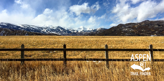
View of Mt. Daly from McLain Flats Road

Aspen, CO – Medium – 4.3 Miles – Road Bike – Paved

McLain Flats Road (CR 19) is an intermediate/moderate road you can bike. This is a 4.3 mile paved road linking Aspen and Woody Creek, CO. It is a 4.3 mile ride from Cemetery Lane (Stein Park) to the Upper River Road (CR 17)/Smith Hill Way intersection (Jaffee Park).

McLain Flats Road (Aspen)


View Larger Map
Point to Point

McLain Flats Road (Woody Creek)


View Larger Map

Comments

Subscribe
Notify of
guest
0 Comments
Inline Feedbacks
View all comments
Posted in 4-7 Miles, Aspen, Medium, Moderate, Paved, Road Biking, Trails, Woody Creek

By using this site you agree to the terms of our User Agreement. Read our Disclaimer.

Trail Search

Find a trail. Use 1 or all 4 drop downs to customize your search for the right trail.

Dog Friendly:

  or  

Park Search

Find a park. Use the drop downs to find the perfect park.

Dog Friendly:

  or  

Featured and Mentioned On

Questions? Email us at info@aspentrailfinder.com
By using this site you agree to the terms of our User Agreement. Read our Disclaimer.